Table of Contents
Bellingham Bay Downwinding
The Bay
- Downwind & Laps
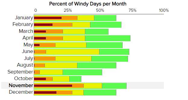
- Prevailing winds - most commonly from south to north but sometimes can work from north to south
- Laps - start and end at same location - paddle upwind and turn around to downwind surf. Repeat # of times preferred.
- Typical South to North Downwind Run Sequence (check Bay Launch Locations for more putin/takeout information)
- Wildcat Cove protected launch with boat ramp, typically you have to paddle out into the bay across waves and wind from the south. How much “west” there is determines how far you want to paddle west before heading north so you will not immediately be pushed back into the east shore. Too much west? You should probably just do in and out laps - trying to paddle north will just be an unpleasant beam wave fight, unless for some reason that is the training you are looking for on the day.
- Governor's Point typical gathering point for everyone to check buddy status and is an opportunity to pull close to the point if anyone needs to take out due to issues, too extreme conditions, etc. Map.
- Chuckanut Bay to the right of Governor's Point opens into Chuckanut Bay where the sound end offers protection from South wind and waves along with several takeout options. The bay fetch will build big waves toward the bay north end on big days, although you may still be able to get across to Teddy Bear Cove which has a protected takeout behind its north end rock outcropping. The trail there is a bit of a winding uphill walk. Chuckanut Bay and the surrounding hills often capture wind and send it into the bay along with waves with a more easterly push which can create criss-cross wave interaction with more southerly waves coming from farther south.
- Clark's Point north end of Chuckanut Bay. On days with west waves you can get significant rebound from the steep shore going north from here.
- Point Point Buoy about 2/5 mile off east shore not very far from Marine Park now. If there is any strong east you should probably already be well right of the buoy if you want to take out at MP unless you are a strong paddler with no problem going sideways in big wind and waves.
- Takeout Options in order going north and eventually northwest along the curve of the bay's north end
- Marine Park, Community Boating Center, Boulevard Park, Glass\Cornwall Beach (or the new park when it is complete in 2029), Waypoint Park, Squalicum Harbor Boat Launch, Squalicum Beach (adds almost 3 miles over takeout at MP), (and Locust Beach if you get pushed way west). Marine Park can give you a bit of protection from east wind, but if you go past the drydock just north of MP you can again get hit by stronger east winds and waves pushing you to the west.
- Surf
- Once in a blue moon Bellingham Bay may get strong enough wind swell to create some shore surf, but it is rare. South winds can sometimes also build a little bit of shore waves at the northern beaches in the Bay.
- There are a few fairly dedicated board surfers who seem to find more frequent opportunities at Birch Bay. And if you want to start to practice getting in and out through shore break, Birch Bay can be one place to start that more frequently has a bit of shore break, but is almost always just quite moderate in comparison to places around the world that employ surf lifesavers.
- Boat Wakes
- …
Conditions
- …
Duncan Howat speaking about the Bay in stronger weather:
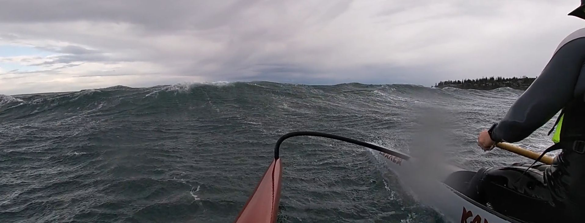
Well the thing about the weather and wind forecast is kinda this: when NOAA is calling for Gale Warning , (34-47 knots,or 39-54 miles per hr) SE, or even S,makes it a little strong and difficult to get away from the cove (Wildcat cove start), and then the mix up out of Chuckanut Bay for a mile or two makes for a very challenging run, except for those who have done it many times or other similar runs. That 40 + wind can get you, particularly in a surfski in winter like conditions. Gale Warning = 5-6 foot seas ,mixed even without much tide, Mix in a big ebb, then it can get big
The Bay When It's Too Big For Most
Ana Swetish - SS1, Wilson Reavley & Kate Baring SS2
.
Videos
Photos
- …
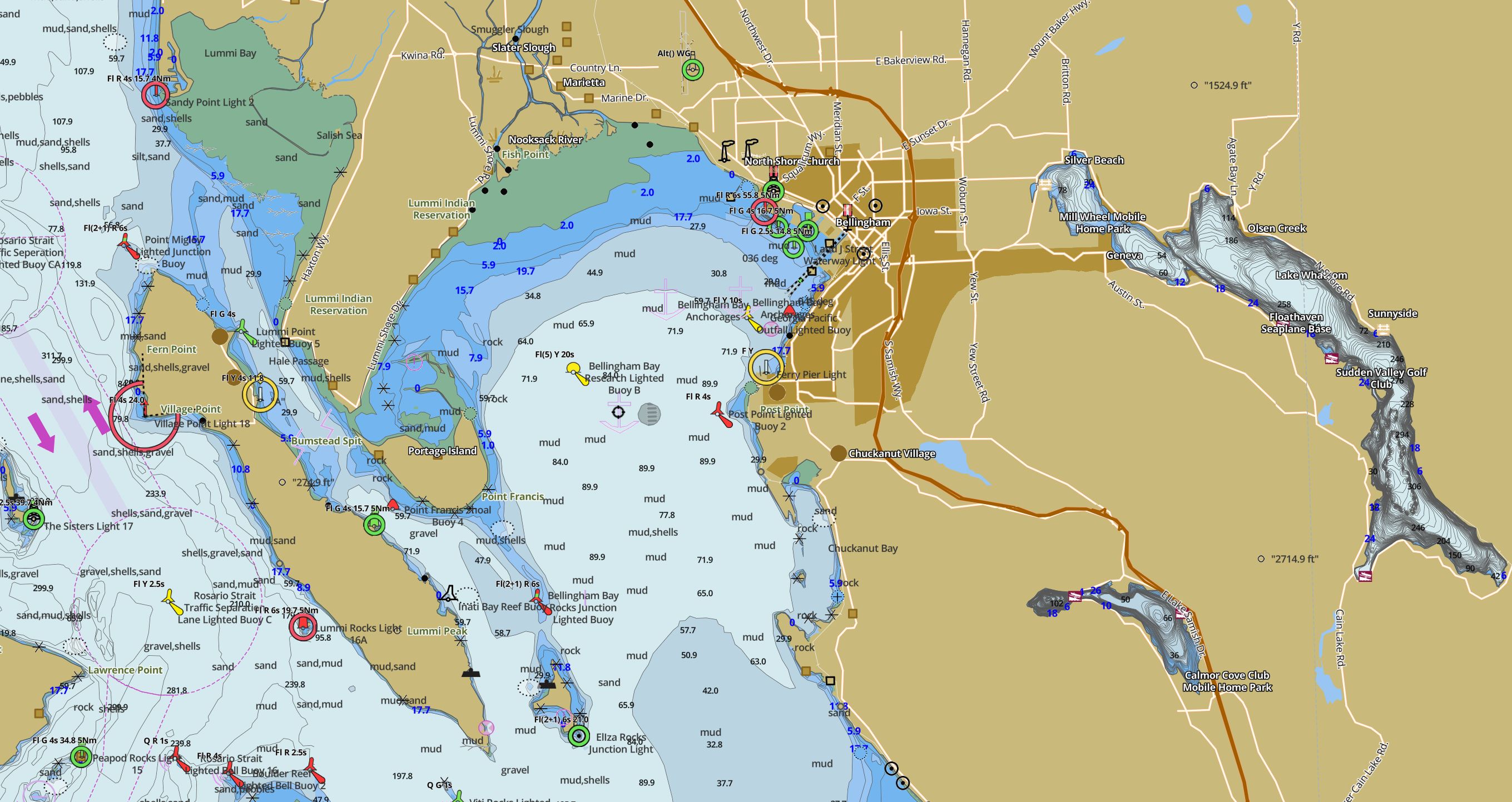
Bellingham Bay click to enlarge map:fishing-app.gpsnauticalcharts.com
This page has been accessed for: Today 3 / Yesterday: 10 Until now: 123